| Article ID | Journal | Published Year | Pages | File Type |
|---|---|---|---|---|
| 8179397 | Nuclear Instruments and Methods in Physics Research Section A: Accelerators, Spectrometers, Detectors and Associated Equipment | 2013 | 7 Pages |
Abstract
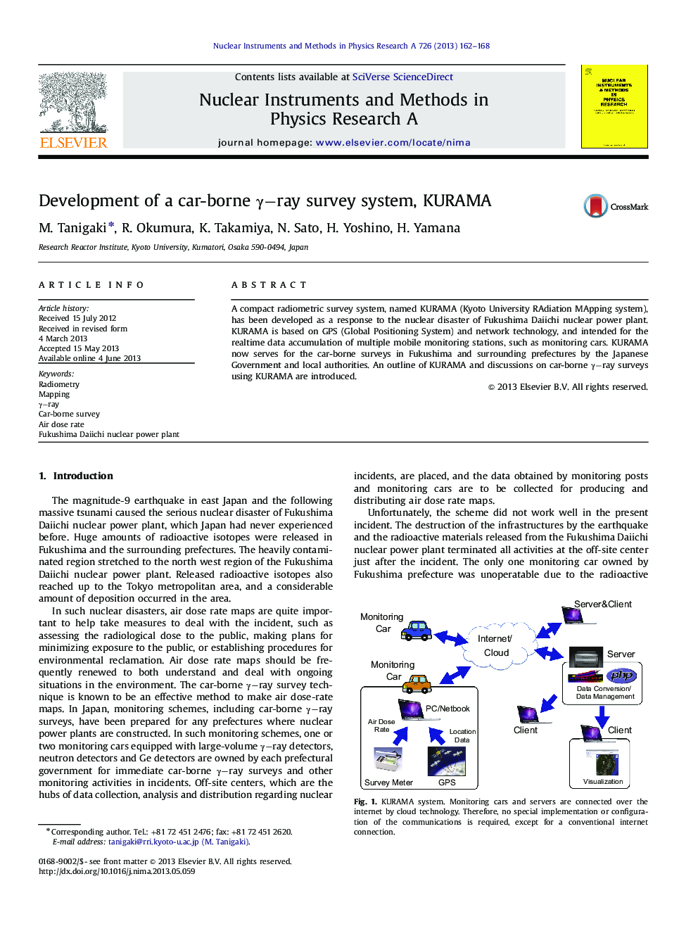
A compact radiometric survey system, named KURAMA (Kyoto University RAdiation MApping system), has been developed as a response to the nuclear disaster of Fukushima Daiichi nuclear power plant. KURAMA is based on GPS (Global Positioning System) and network technology, and intended for the realtime data accumulation of multiple mobile monitoring stations, such as monitoring cars. KURAMA now serves for the car-borne surveys in Fukushima and surrounding prefectures by the Japanese Government and local authorities. An outline of KURAMA and discussions on car-borne γ-ray surveys using KURAMA are introduced.
Related Topics
Physical Sciences and Engineering
Physics and Astronomy
Instrumentation
Authors
M. Tanigaki, R. Okumura, K. Takamiya, N. Sato, H. Yoshino, H. Yamana,
